
Freshwater Beneath the Sea – 2025
Freshwater Beneath the Sea? New Survey Aims to Unlock Hawaii’s Hidden Aquifer
West Hawai‘i — June 2025
A groundbreaking scientific expedition will soon set sail off the coast of West Hawai‘i in search of something unexpected: fresh water beneath the ocean floor.
The Natural Energy Laboratory of Hawaii Authority, with funding from the Hawai‘i State Legislature, have contracted with researchers from the Hawai‘i Institute of Geophysics and Planetology and Scripps Institution of Oceanography for a two-week offshore imaging survey.
The goal is to confirm the existence of a potentially massive underground reservoir of fresh or brackish water hidden beneath the seafloor—an idea that challenges conventional understanding of island hydrology.
The roots of this investigation trace back to 2018, when scientists first detected anomalies suggesting a deep, confined aquifer where none should exist. Their theory? Rainwater may be funneled underground trapped beneath layers of volcanic basalt and ash, extending far beneath the basal freshwater lens and even miles offshore.
If proven, this deep water could explain long-standing mysteries about Hawai‘i Island’s water cycle—namely, why observed coastal discharge doesn’t match estimated groundwater recharge. In simple terms, a lot of water is missing from current models.
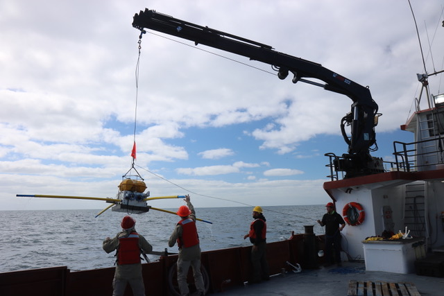
The 2025 survey will use advanced electromagnetic imaging techniques. Instruments will be deployed on the seafloor to listen for electromagnetic echoes, while a 150-foot-long towed antenna emits a low-power signal that is recorded on a 3,300-foot-long receiver array. The study will span three areas: north of Kiholo Bay to Honōkohau Harbor, the coastline south of Kailua Bay to Kealakekua, and a deep offshore transect reaching depths of 2,900 meters.
To minimize environmental impacts, the team will monitor for marine life, including whales, dolphins, seals, sea turtles, and whale sharks. A support boat and onboard observers will temporarily suspend operations if animals or vessels approach the study area. All of the deployed equipment will be retrieved after data collection, except for eight 1-square-meter concrete pedestals will remain along the deep transect to degrade naturally.
A comprehensive review of more than 400 studies has found no significant risks from these methods to marine life.
If confirmed, this hidden aquifer could reshape our understanding of island hydrology and inform future water resource planning—offering a potential new source of fresh water in a region increasingly affected by drought and climate change.
ADDITIONAL INFORMATION AND LINKS
Short Project Summary (pdf)
FAQ (pdf)
Location Map and Array Schematic (pdf)
References:
- Attias et al. GRL Manuscript (pdf)
- Attias et al. GRL Supporting Information (pdf)
- Attias et al. Science Advances Manuscript (pdf)
- Attias et al. Science Advances Supplementary Materials (pdf)
- Buchanan et al. IAGC Manuscript (pdf)
- BOEM EMF and Marine Life (pdf)
- West Hawaii Deep Water Survey Project Description (pdf)
For more information, contact: [email protected]